Description
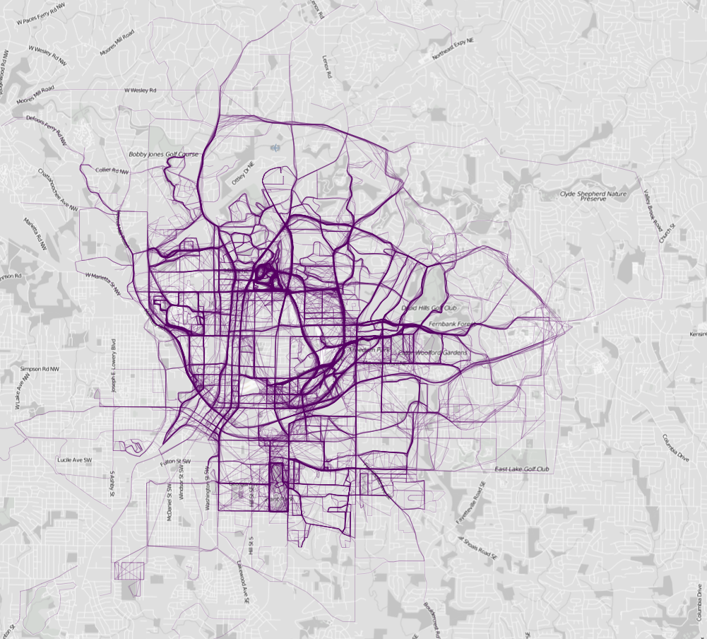
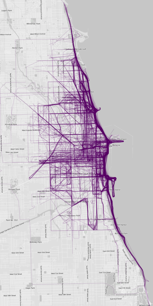
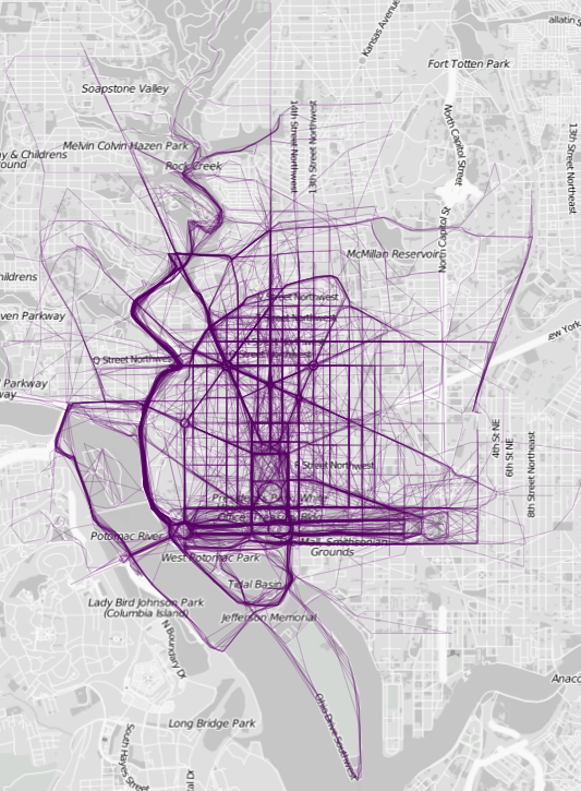
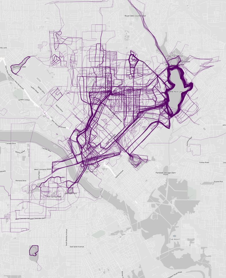
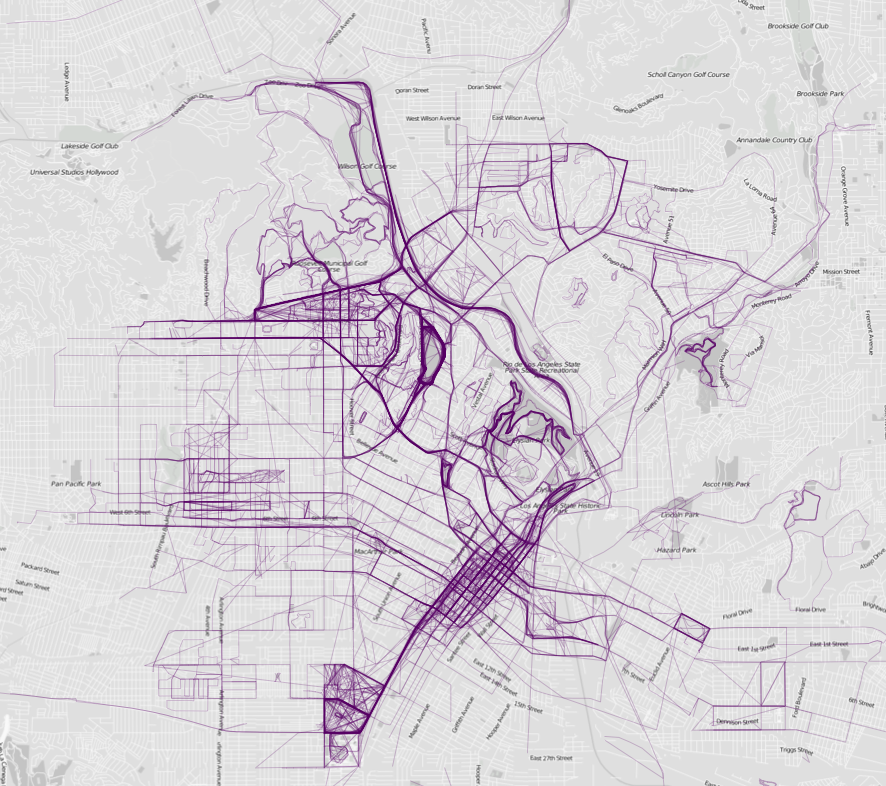
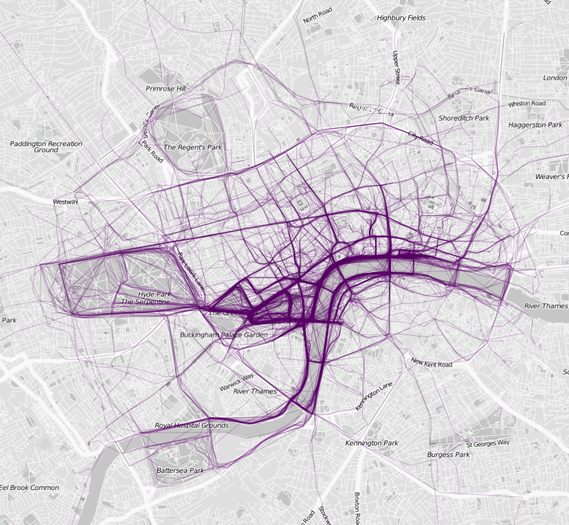
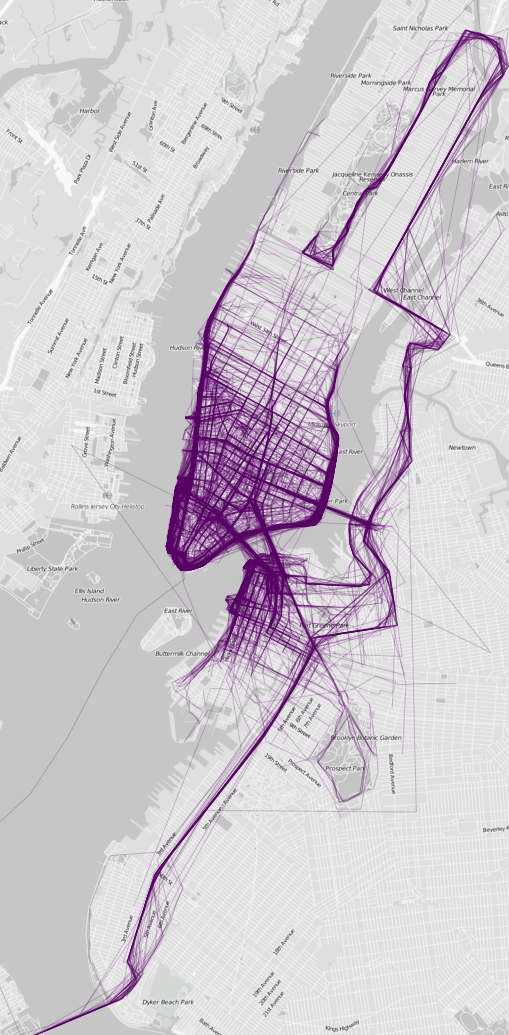
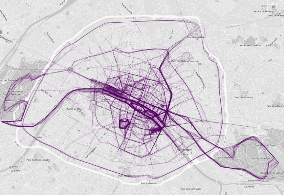
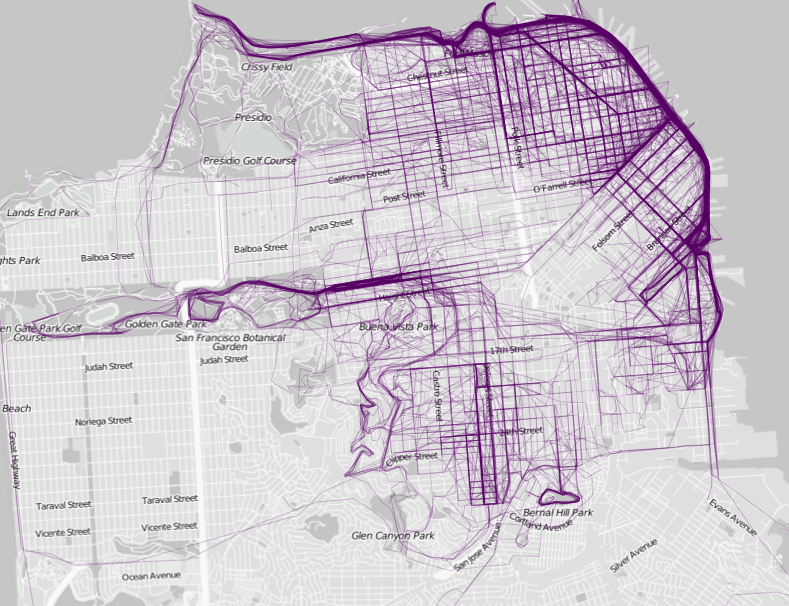
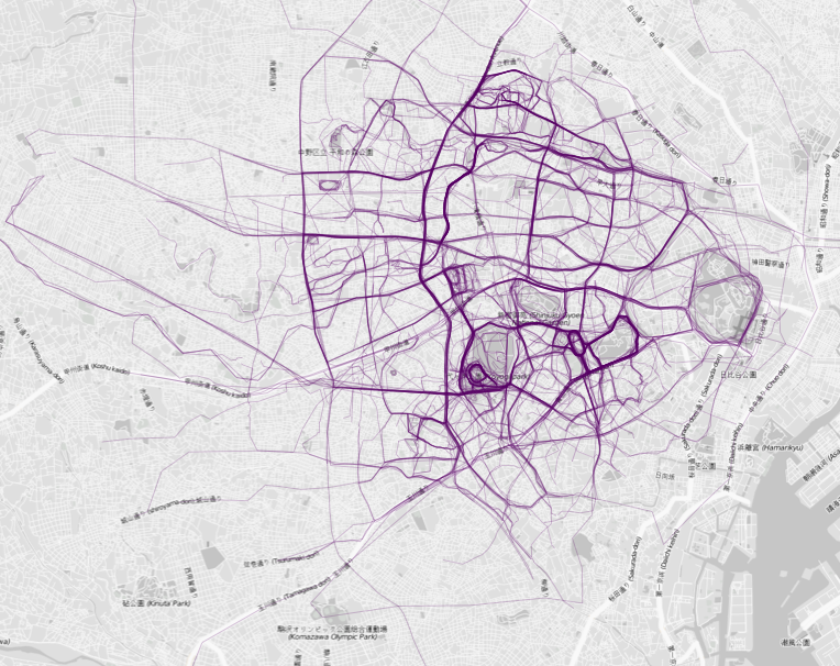
Running route visualizations by Nathan Yau (FlowingData, 2014), who pulled public data from RunKeeper.com to map out the common running routes of twenty major cities including New York, London, Tokyo, Paris, and San Francisco. By aggregating GPS data from running apps, the maps reveal how urban geography shapes exercise patterns — runners gravitate toward parks, waterfronts, river paths, and popular corridors while avoiding highways and industrial zones. The resulting heat maps show that each city has a distinctive running signature shaped by its topography, green spaces, and street layout. The project demonstrates how aggregated personal fitness data can reveal collective urban behavior patterns.