Description
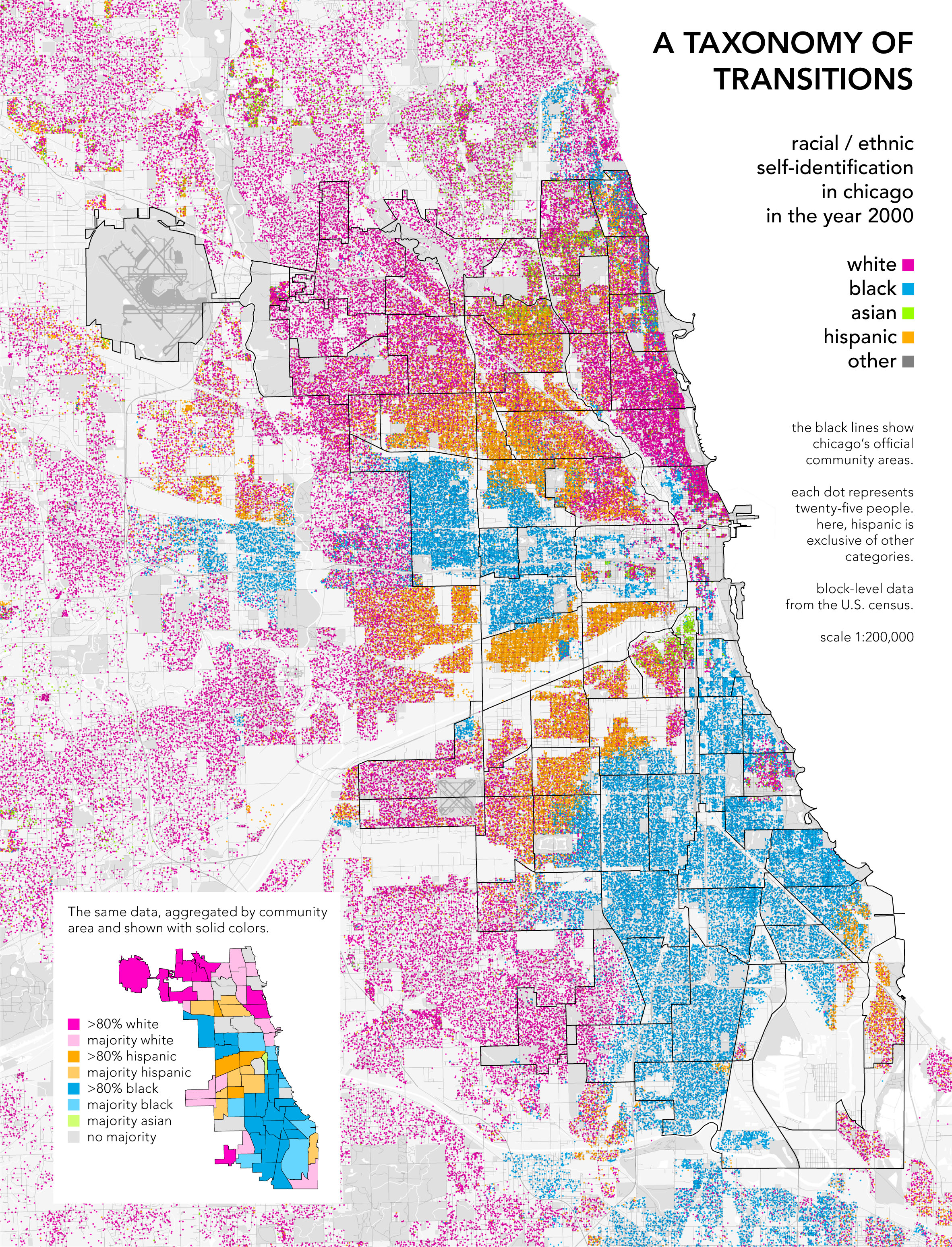
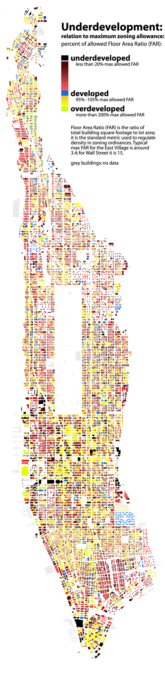
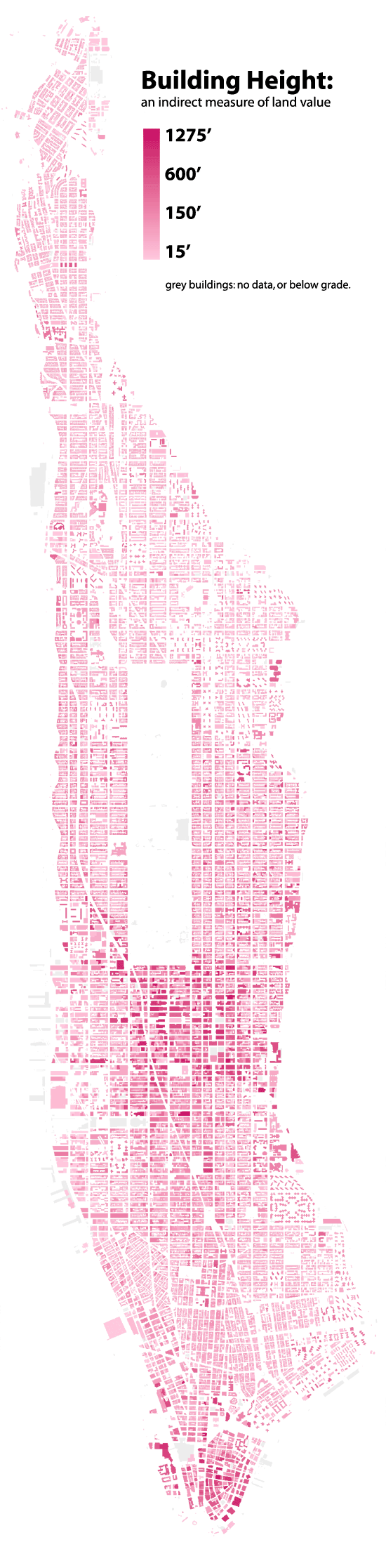
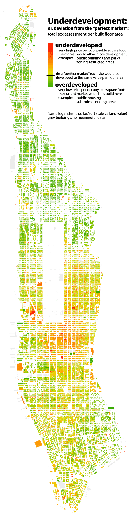
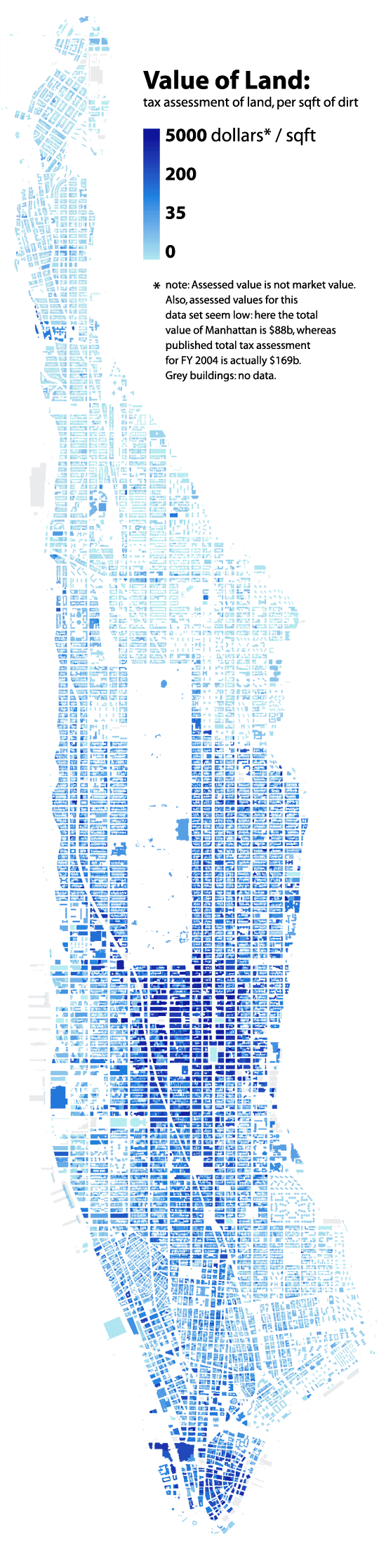
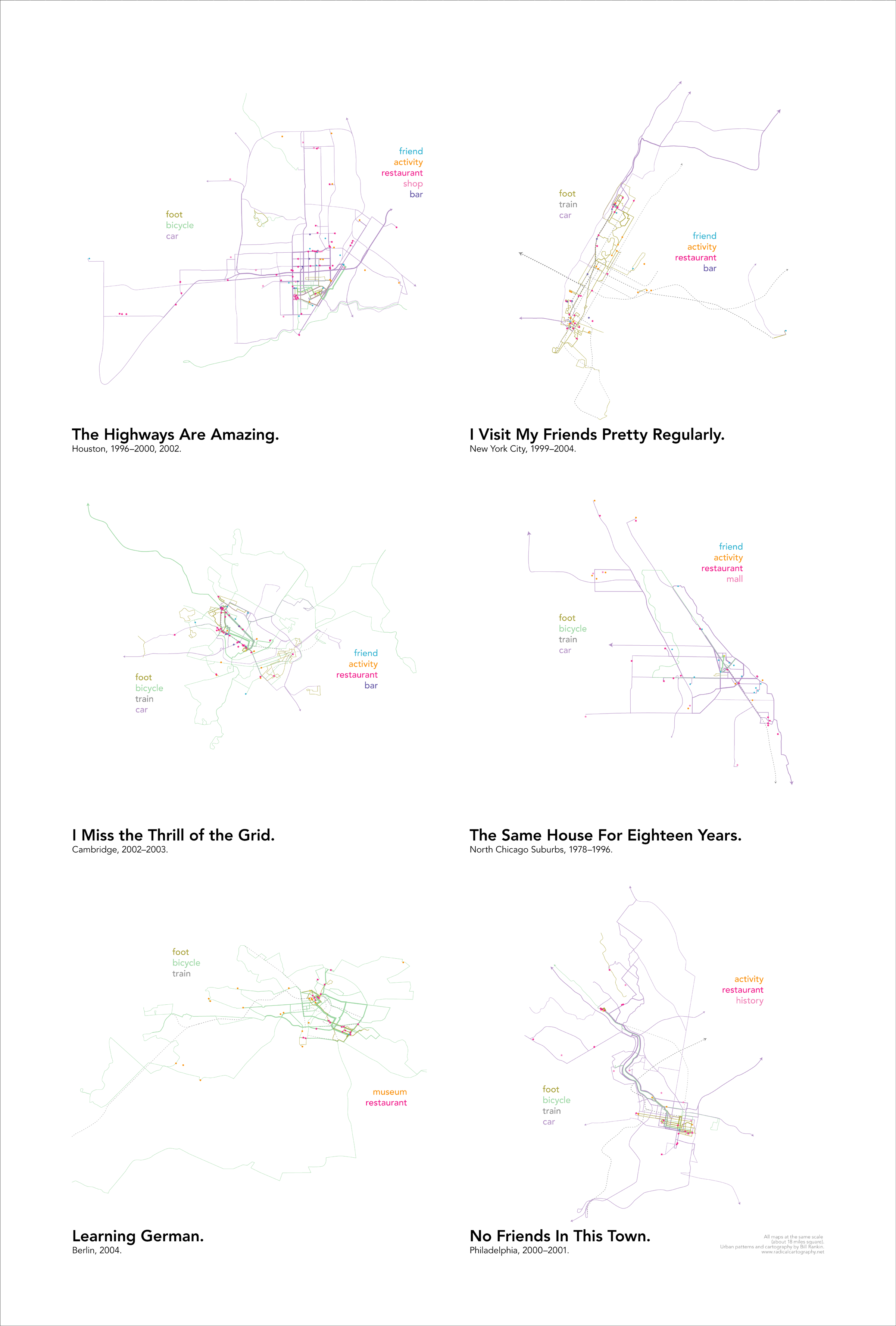
Urban mapping and data visualization work by Bill Rankin, a historian of science and cartographer at Yale University. His website radicalcartography.net, launched in 2004, features innovative maps exploring city structure through zoning, land use, demographics, and infrastructure data. Rankin's 2009 dot density map of Chicago's racial composition — one dot per person, colored by race — directly inspired Eric Fischer's nationwide Census Dot Map project. Rankin approaches mapping as a critical practice, questioning how cartographic choices shape understanding. He is the author of "After the Map: Cartography, Navigation, and the Transformation of Territory in the Twentieth Century" (University of Chicago Press, 2016).