Description
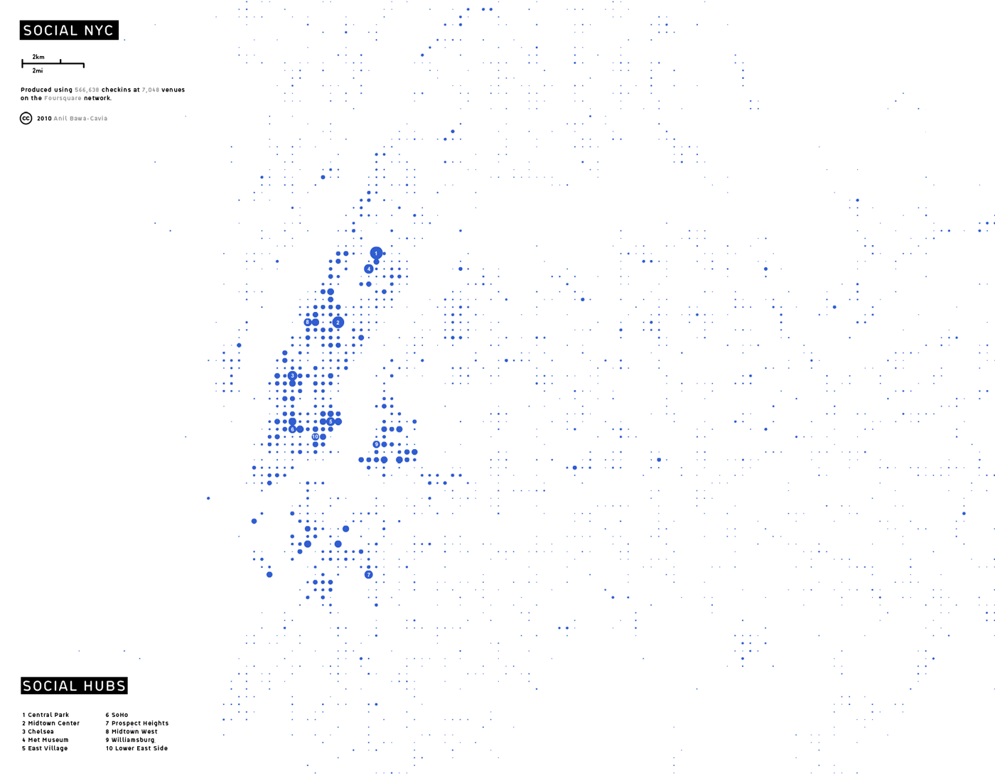
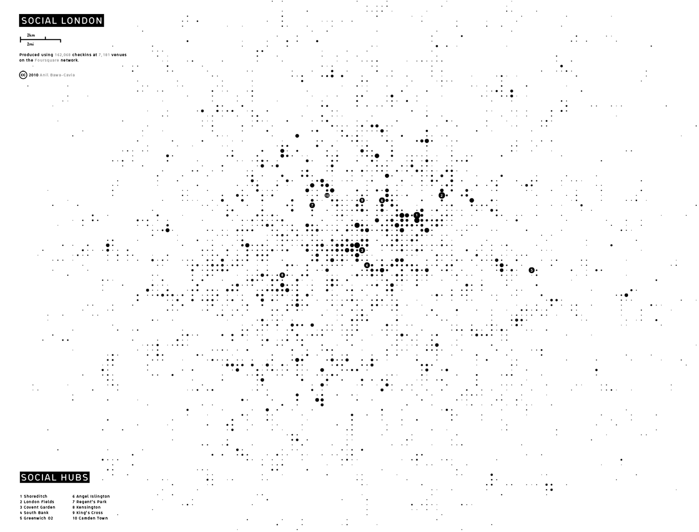
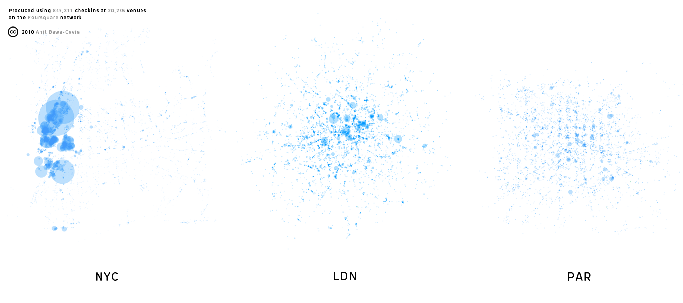
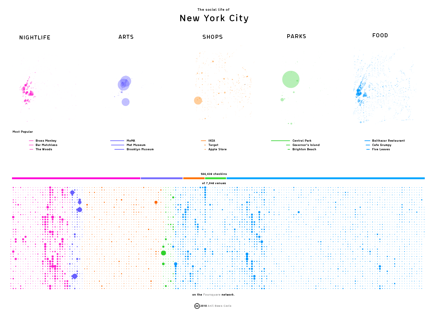
The modern metropolis can often feel like a social archipelago – fragmented islands of social activity separated by large areas dedicated to commercial workplaces, flows of vehicles, residential sprawl or industrial sites. These islands of high density social encounter can be mapped using emerging data from location-based networks such as Foursquare. By visualising the aggregate data produced by these social networks, we can see how social activity in a city is distributed. In these maps, activity on the Foursquare network is aggregated onto a grid of ‘walkable’ cells (each one 400×400 meters in size) represented by dots. The size of each dot corresponds to the level of activity in that cell. By this process we can see social centers emerge in each city.