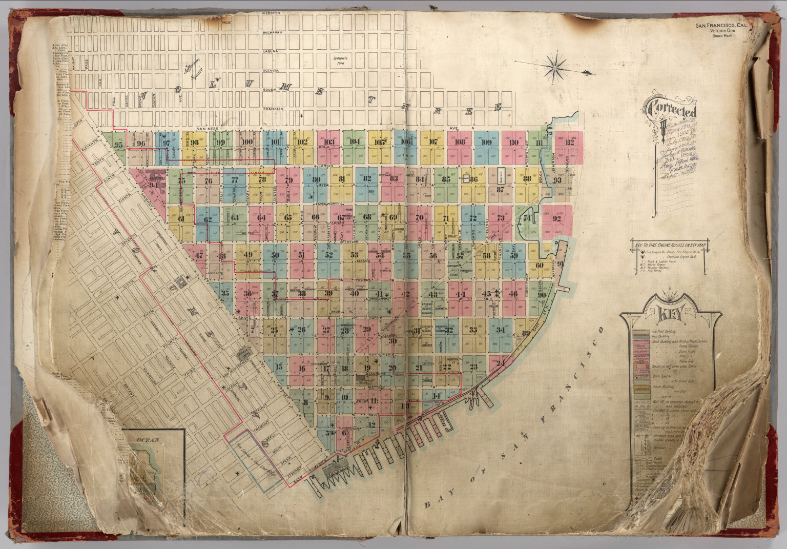
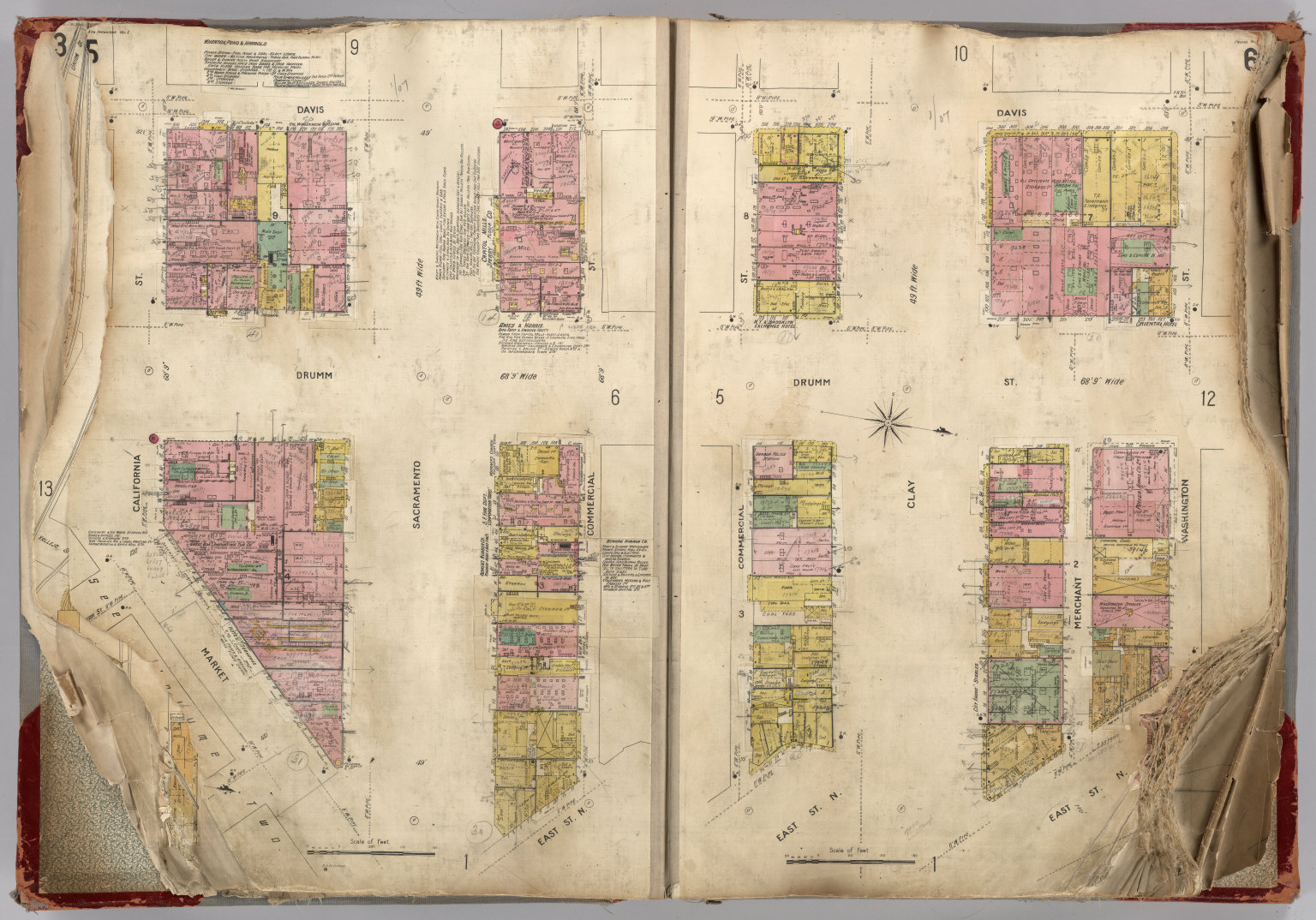
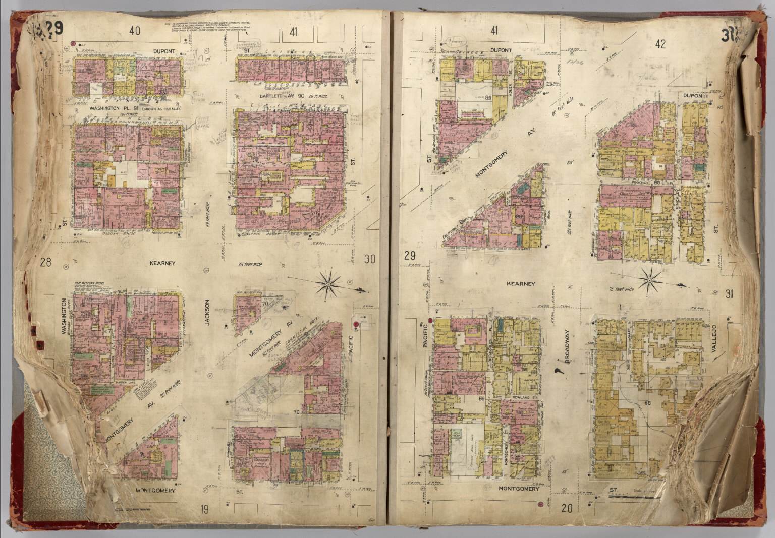
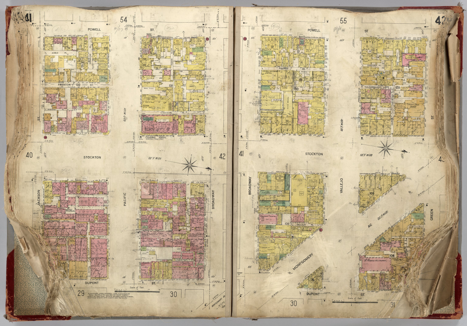
Description
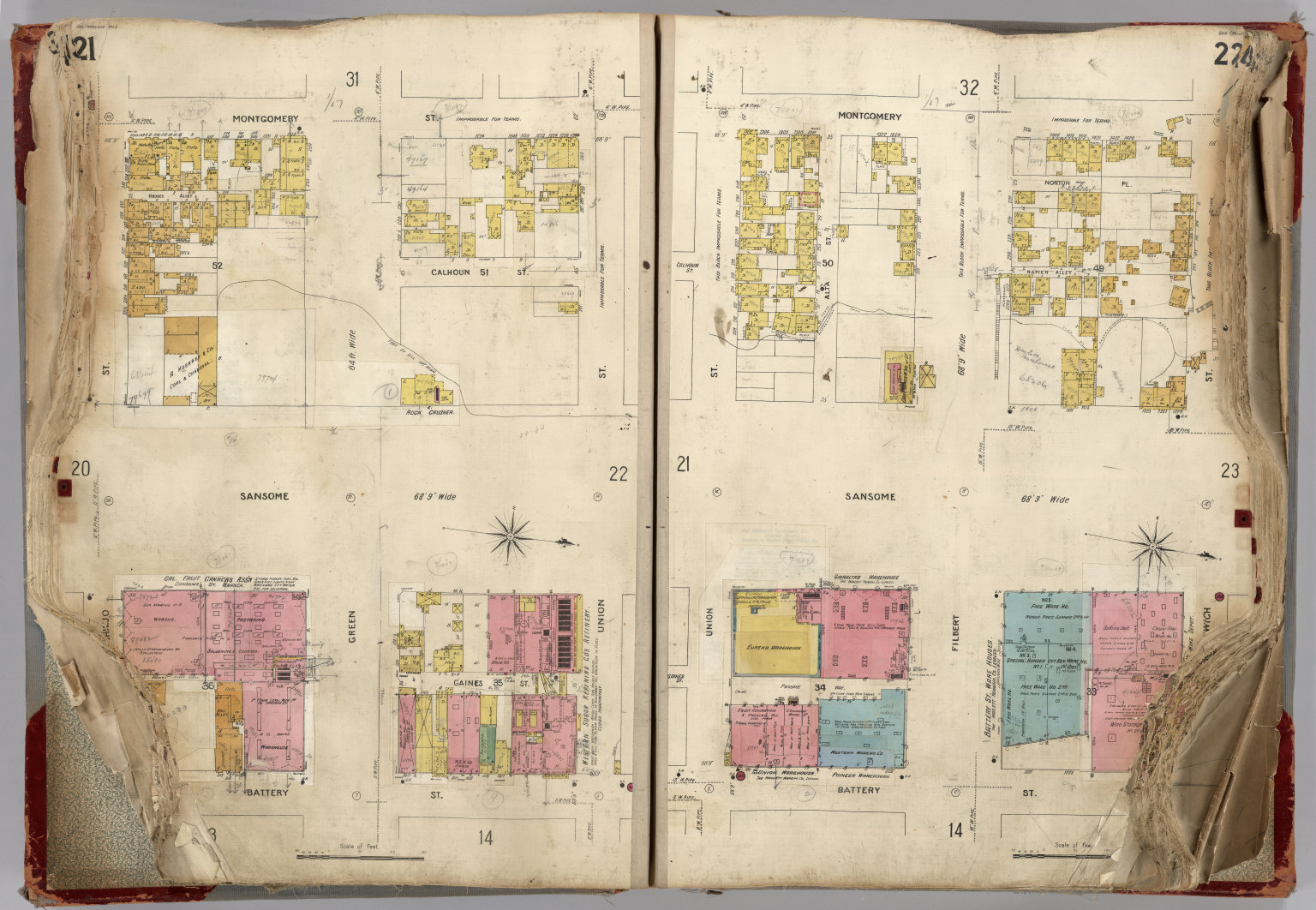
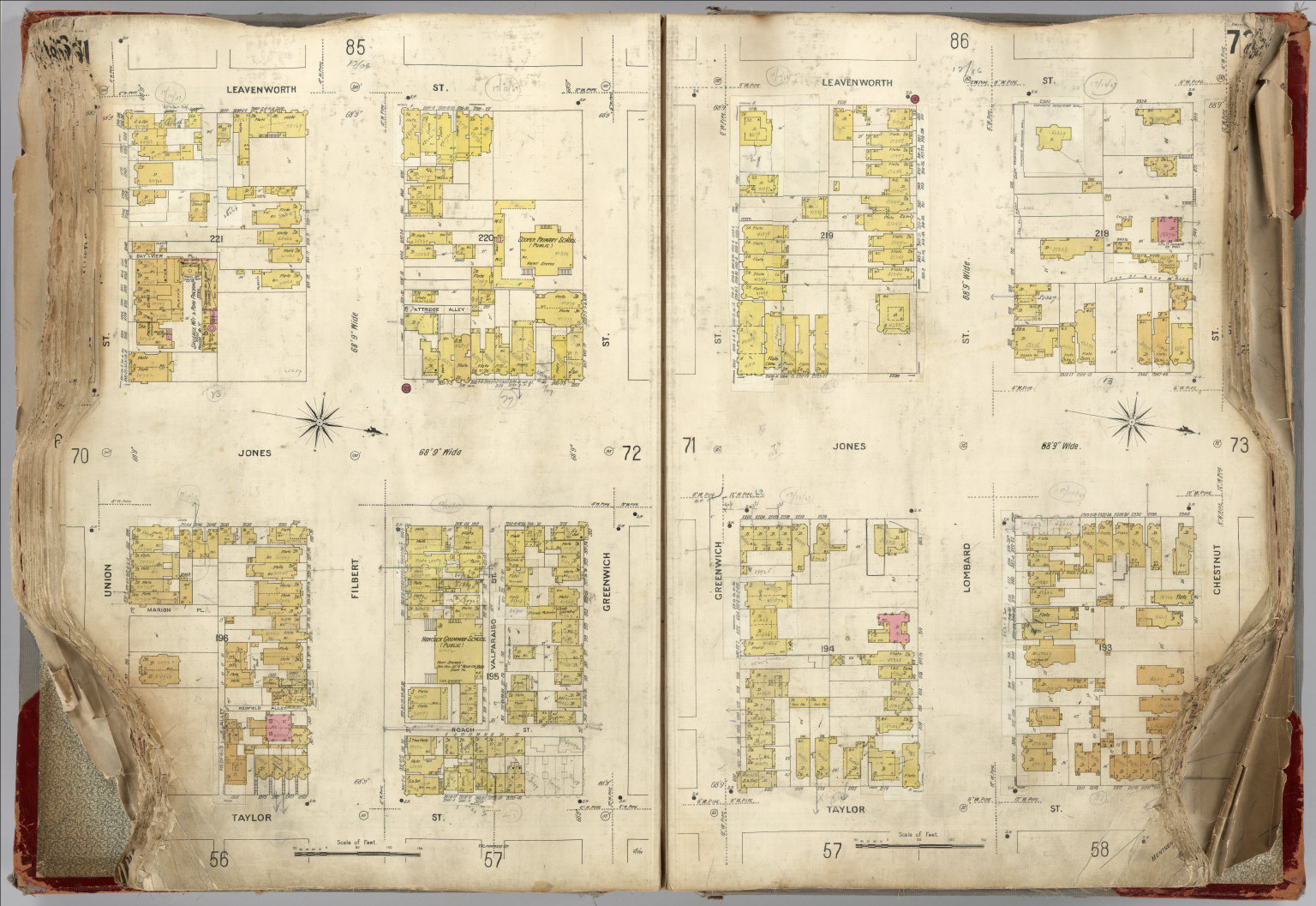
Sanborn fire insurance maps of San Francisco before the 1906 earthquake. The Sanborn Map Company, founded by Daniel Alfred Sanborn in 1867, produced detailed fire insurance maps of over 12,000 American cities and towns. Each map shows individual buildings color-coded by construction material (brick, wood, stone), with annotations for building use, number of stories, windows, and fire suppression systems. The pre-1906 San Francisco maps are historically significant as block-by-block documentation of the city before it was largely destroyed by the April 18, 1906 earthquake and subsequent fires, which destroyed over 80% of the city. The Library of Congress holds the largest collection of Sanborn maps.