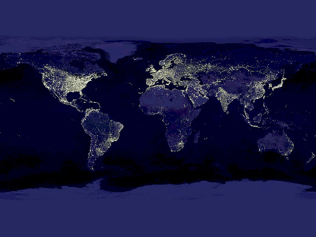
Description
NASA satellite composite showing city lights across Earth at night, revealing patterns of human settlement, energy consumption, and economic development. Also known as the "Black Marble," the composite is produced using data from NOAA/NASA's Suomi National Polar-orbiting Partnership (Suomi NPP) satellite, launched in 2011. The image stitches together cloud-free nighttime observations to show artificial lighting across the globe. Bright clusters mark major metropolitan areas, highways trace illuminated lines between cities, and dark zones reveal oceans, deserts, and undeveloped regions. The visualization has become an iconic representation of human civilization's footprint, widely used in geography, urban studies, and environmental science.