Description
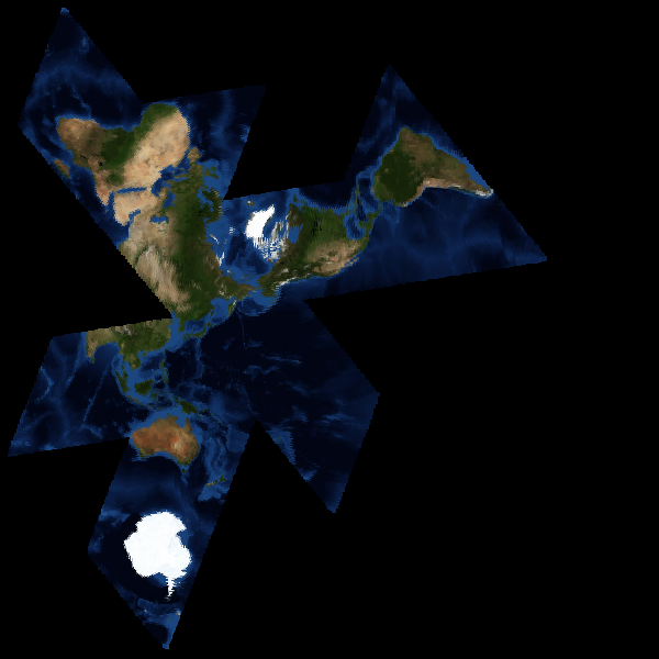
Buckminster Fuller's icosahedral world map projection showing Earth's continents with minimal distortion, unfolding to reveal one interconnected landmass surrounded by ocean — what Fuller called "Spaceship Earth." Created in 1943 (originally on a cuboctahedron, revised to an icosahedron in 1954) and patented in 1946, the Dymaxion map can be unfolded into a flat map with significantly less distortion of relative sizes and shapes than Mercator or other standard projections. Unlike conventional maps, it has no "right way up" and no visual hierarchy between north and south. The map was first published as a photo essay in Life magazine on March 1, 1943. The Buckminster Fuller Institute continues to promote its use.